|
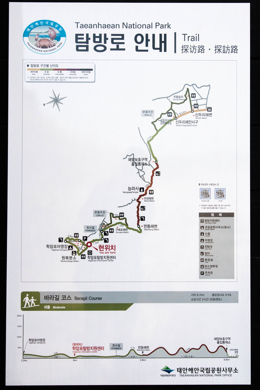
Seeing that the weather was going to the lovely on Sunday, Kevin and I decided to tackle the stretch of Haebyeongil which started at the Hakampo and ended at Shinduri. Know as Pala Gil (바라길), it connects to the Sowon Gil (소원길) at Shinduri. We took the first bus left for Hakampo and 09:30 and half an hour later, we were at our starting point. We started by exploring the harbour and then made our way to the beach. The tide was low enough today that we were able to walk to one of the islands near the coast. The rocks were covered with oysters which made me wish I had a knife with me to shuck these oysters. After being distracted with the abundant amount of free seafood, we headed towards the trail were slowly on our way. We passed through the beaches of Guryepo (구례포), Meondong (먼동) and once we arrived at Neugpa Temple, the trail took us into the woodlands. Once we reached the clearing, we arrived at the Shinduri Sand dunes (신두리 해안사구) which we never really expected to see. After another hour of walking, we arrived at Shinduri and took the 14:25 bus back to town. It took a total of 4 hours to complete the 12 km section. Now that I have finished northern section of Haebyeongil, off to the southern section!
3 Comments
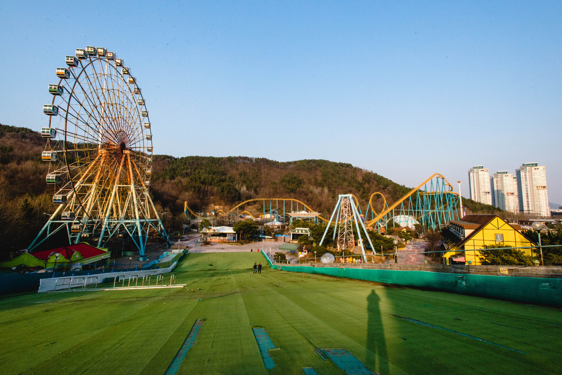
We arrived on site when the sun was beginning to set over the mountains in the distance. There was this eerie yet beautiful atmosphere while we were exploring the site. The light was soft and it made everything look gorgeous, The favourite photo was the one of the Merry-Do-Round but it took a bit of thinking and composing to make it seem as if the horses were alive, It did feel quite odd exploring a place which used to be filled with laughter and happiness since now quietly decays slowly under the foot of the mountain. Our goal was to fully explore the park but adventure was cut short after the guard caught me climbing up the stairs up the roller coaster. I need to work on my ninja skills.
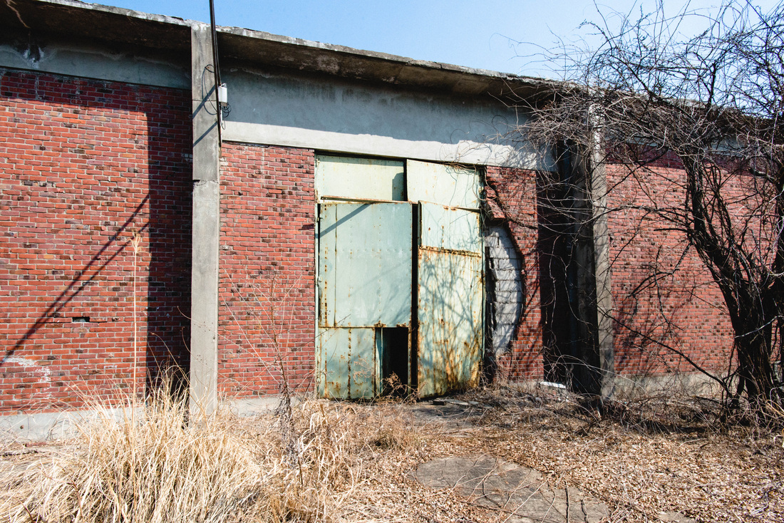
The place was an unexpected find in general. It seems to have closed down for some time and most of the entrances were welded shut until we found a small opening and we went it. Behind the walls was this massive space with over hanging beams suggesting the area was an assembly line. The further we ventured, the darker it got so we had to turn on our flash lights in some areas. It was a bit dangerous since there were places where you could easily trip over or fall into in the darkness. Since the air was unbearable, we didn't venture too deep into the complex and headed out for fresh air.
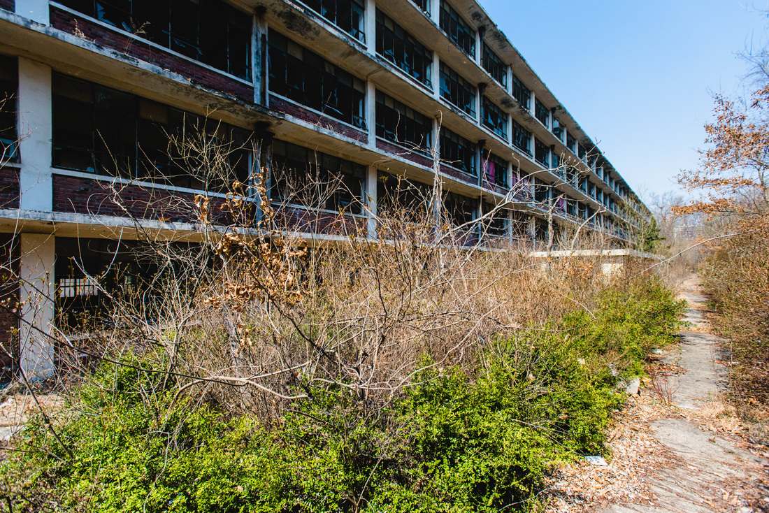
My friends and I planned this trip back in February about visiting this large abandoned school on this very weekend. Once we all arrived on site, we found out that the locals who were tending their fields right outside the school grounds were trying to find out what we were up to hence we took a big detour until we finally arrived near the building. The school itself is quite large, having two wings which were five floors each and had a lot of classrooms. As we explored the site, there were some rooms which were badly burnt, but the classrooms more or less looked the same, with the people before us either leaving their name on the blackboards or spray painting on the wall. One thing we didn't expect to find was the basement, which had a large mechanical pump or something sitting in the far left corner, which only be seen if you had a flashlight. To actually illustrate how large the school was, it took a good 2 hours to fully explore the whole building.
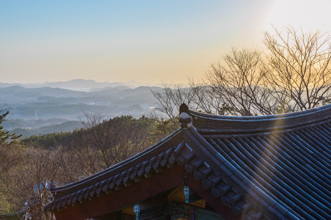
It has been a while since I've hiked up the mountain again mostly due to the weather being cold as well as me being lazy. Last weekend when I went up to the top with a few friends, the air was extremely hazy and I couldn't get the sunset photo that I wanted. Seeing that the weather would be clear today, I decided to head up after work to take a photo of the sunset. Using The Photographer's Ephemeris App on my phone, I was able to plan around what time to arrive at the summit before the sunset as well as where the sun will set. I took what I called the easy route since it was a paved road and it took less time. However, the sun didn't set where I expected it to (according to the app, I have to wait until September) but I did manage to get some shots that I am pleased with.
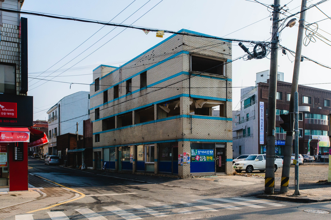
While I was coming back from the doctor's office yesterday afternoon, I stumbled upon what seemed to be an abandoned building at a busy intersection in town. Doing a bit of scouting, I found out the doors were unlocked and I decided to check out the site this morning. This building used to be the office for the Daejeon Maeil (Daily) Newspaper but was later converted into a restaurant which occupied the first two floors leaving the third floor as a private residence. Most of the windows were stripped from the building. Since it was standing in a busy corner of the intersection, I stayed close to the walls so I wouldn't be spotted by the locals. There was a lot of of rubble and shards of glass laying all over the site. After a good 30 minutes of looking around, I decided to call it a day and head home.
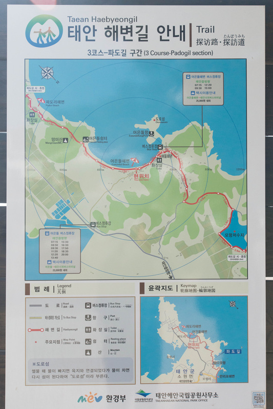
Update: The building has been demolished After having a good nights rest from the 22km trail yesterday, I decided to tackle the Pado Gil (파도길), which is a 9km trail starting from the fishing village of Pado and meets up with the Sowon Gil (소원길) at Manripo. With my friend Kevin, we took the 1130 which was headed to Pado. The bus dropped us off at the beginning point of the trail and we were on our way. On route we passed through Pado beach, Eoondul beach as well as a small beach which apparently the locals found gold flakes in the sand. The hike took us through several small hills where we were able to get a panoramic view of the coastline. Once we arrived a Mohang harbour, it was not before long we arrived in Manripo. Not bad for a 3 hour hike on a Sunday afternoon.
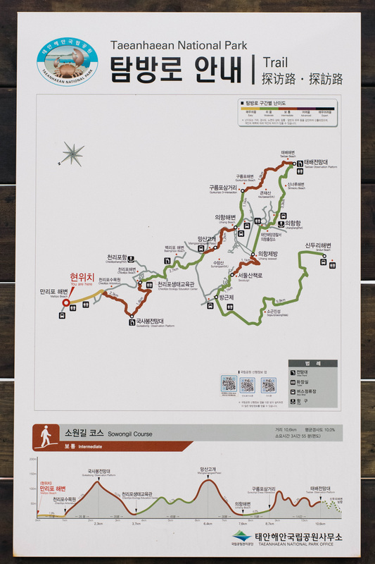
Feeling guilty after eating two instant noodles for dinner the night before, I decided to tackle one of Taean's most famous trails, the Haebyeongil's (The Coastal Trail) Manripo to Shinduri section know as Sowon Gil (소원길), which is approximately 22 kilometers. I got up early the next day and took the 0630 bus which headed to Manripo beach and started from there. The trail overlaps with some of the roads so in order to know if you were heading in the right direction required paying attention to the Haebyeongil logo. Along the way I got to visit the beaches of Manripo, Cheonripo and Baekripo and then after a hike over a mountain, I arrived at Uihang. I hiked my way to the northern tip of the peninsula which was called Taebaek Observation Point. From there I got to see my finish point, Shinduri beach, which was still 12 kilometers away. Interestingly, parts of the trail consists of several causeways and seeing that the tide was low today, I was able to walk along parts of the coast line which would have been inaccessible during high tide. Along the trail there are numerous seawalls which I think were constructed in order to reclaim land for farming. By the time, I arrived at Shinduri, I spent a total of 6 hours walking and hiking 21 kilometers from Manripo. Although it was a long walk/hike, this section represents only 1/5 of the Haebyeongil Trail system in Taean. Would I do this section again? Probably not but the other sections are definitely on my to do list once the weather gets warmer.
|
Archives
April 2017
Categories
All
Please also visit |

 RSS Feed